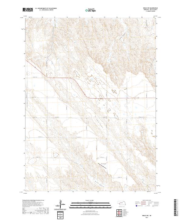
2021 Map of Brule NW
USGS Topo · Published 2021About this map
Deep-cut drainage systems define this section of the Nebraska panhandle, where the high plains break into a series of sharp ravines. Eagle Canyon and Coyote Canyon dominate the northern terrain, while Brule Canyon and Chase Canyon mark the south, illustrating the complex erosion patterns of the region. This landscape is sparsely populated, yet it is knit together by a rigid grid of rural roads and the presence of the El-Co Airport in the south-central township. The map provides a precise view of the Public Land Survey System divisions, showing the interface between the open ranch land and the steep descents of Ash Camp Canyon.
Find a feature on this map
29 named features on this map. Tap any name to fly to it.
Don’t see what you’re looking for? This feature index may not catch every label — zoom into the map to look around manually.
Map Details
Editions of this 2021 Brule NW Map
This is the sole edition of this map. No revisions or reprints were ever made.
Other maps of this area

1897 · Ogallala
USGS Topo · 1:125,000

1900 · Chappell
USGS Topo · 1:125,000

1900 · Ogallala
USGS Topo · 1:125,000

1954 · Scottsbluff
USGS Topo · 1:250,000

1954 · North Platte
USGS Topo · 1:250,000

1956 · North Platte
USGS Topo · 1:250,000

1957 · North Platte
USGS Topo · 1:250,000

1958 · Scottsbluff
USGS Topo · 1:250,000

1961 · Big Springs
USGS Topo · 1:24,000
1961 · Brule
USGS Topo · 1:24,000