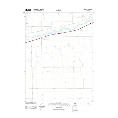
2011 Map of Brule SE
USGS Topo · Published 2011About this map
The South Platte River cuts a wide, braided path through this section of Keith County, Nebraska, defining the region's agricultural and transit corridors. The braided river system is closely paralleled by the Western Canal, which weaves across the landscape south of the main channel. To the north, Chase Canyon marks a break in the upland terrain. This 2011 survey illustrates the modern intersection of irrigation infrastructure and aviation, featuring both Maloney Dam and Detention Dam 1, alongside small aviation sites like Searle Airport and Shelburnes Airport. The landscape is organized by a rigorous grid of rural roads, such as Road W 60 and Road W 30, supporting the large-scale ranching and farming operations typical of the High Plains.
Find a feature on this map
30 named features on this map. Tap any name to fly to it.
Don’t see what you’re looking for? This feature index may not catch every label — zoom into the map to look around manually.
Map Details
Editions of this 2011 Brule SE Map
This is the sole edition of this map. No revisions or reprints were ever made.
Other maps of this area

1897 · Ogallala
USGS Topo · 1:125,000

1900 · Ogallala
USGS Topo · 1:125,000

1954 · McCook
USGS Topo · 1:250,000

1954 · North Platte
USGS Topo · 1:250,000

1956 · North Platte
USGS Topo · 1:250,000

1957 · North Platte
USGS Topo · 1:250,000

1957 · McCook
USGS Topo · 1:250,000

1958 · McCook
USGS Topo · 1:250,000

1961 · Brandon NE
USGS Topo · 1:24,000

1961 · Brandon NW
USGS Topo · 1:24,000