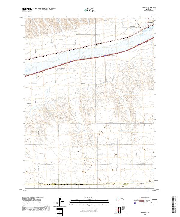
2021 Map of Brule SE
USGS Topo · Published 2021About this map
The South Platte River carves a broad path across this portion of the Nebraska panhandle, serving as the dominant geographic feature in a landscape defined by organized agricultural grid lines and river-valley transport. In the northeastern corner, the outskirts of Ogallala mark the transition from the city's municipal influence to the surrounding ranching and farming lands. Aviation history and local infrastructure are represented by Searle Field near the river and Shelburnes Airport further south, suggesting the importance of private and regional flight in this open terrain.
Find a feature on this map
32 named features on this map. Tap any name to fly to it.
Don’t see what you’re looking for? This feature index may not catch every label — zoom into the map to look around manually.
Map Details
Editions of this 2021 Brule SE Map
This is the sole edition of this map. No revisions or reprints were ever made.
Other maps of this area

1897 · Ogallala
USGS Topo · 1:125,000

1900 · Ogallala
USGS Topo · 1:125,000

1954 · McCook
USGS Topo · 1:250,000

1954 · North Platte
USGS Topo · 1:250,000

1956 · North Platte
USGS Topo · 1:250,000

1957 · North Platte
USGS Topo · 1:250,000

1957 · McCook
USGS Topo · 1:250,000

1958 · McCook
USGS Topo · 1:250,000

1961 · Brandon NE
USGS Topo · 1:24,000

1961 · Brandon NW
USGS Topo · 1:24,000