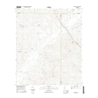
2014 Map of Brundidge SE
USGS Topo · Published 2014About this map
Pea River meanders through the heart of this landscape, forming a natural boundary as it flows past the small communities of Roeton, Java, and Rocky Head. The map documents a rural corridor where Pike, Coffee, and Dale counties converge, characterized by numerous family-named creeks and burial sites that anchor the local genealogy. Waterways such as Clearwater Cr, Huckleberry Cr, and Beaverdam Cr define the drainage patterns of the region, while landmarks like Prestwood Millpond indicate historical land use and water management. Local transit is rooted in a network of county roads connecting scattered settlements like Frisco and New Hope. The prevalence of smaller family and community burial grounds, including Selgar Family Cem and Saint Johns Cem, offers significant detail for researchers tracing the early 21st-century footprint of these Southeast Alabama neighborhoods.
Find a feature on this map
85 named features on this map. Tap any name to fly to it.
Don’t see what you’re looking for? This feature index may not catch every label — zoom into the map to look around manually.
Map Details
Editions of this 2014 Brundidge SE Map
This is the sole edition of this map. No revisions or reprints were ever made.
Other maps of this area

1942 · Enterprise
USGS Topo · 1:125,000

1948 · Ozark
USGS Topo · 1:62,500

1948 · Brundidge
USGS Topo · 1:62,500

1950 · Ozark
USGS Topo · 1:62,500

1950 · Enterprise
USGS Topo · 1:62,500

1950 · Brundidge
USGS Topo · 1:62,500

1953 · Dothan
USGS Topo · 1:250,000

1954 · Dothan
USGS Topo · 1:250,000

1955 · Dothan
USGS Topo · 1:250,000

1960 · Brundidge
USGS Topo · 1:24,000