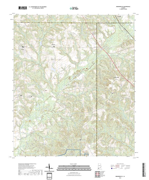
2024 Map of Brundidge SE
USGS Topo · Published 2024About this map
The Pea River and Townard Branch define the drainage of this landscape in southeast Alabama, where the borders of Pike, Coffee, and Dale counties converge. Historically a region of small rural settlements and agriculture, the area is home to numerous family and community burial sites, including the Selgar Family Cem and Strickland Cem near Frisco. The topography is marked by localized water features such as Prestwood Millpond, reflecting the traditional reliance on small-scale water management for local mills or recreation.
Find a feature on this map
52 named features on this map. Tap any name to fly to it.
Don’t see what you’re looking for? This feature index may not catch every label — zoom into the map to look around manually.
Map Details
Editions of this 2024 Brundidge SE Map
This is the sole edition of this map. No revisions or reprints were ever made.
Other maps of this area

1942 · Enterprise
USGS Topo · 1:125,000

1948 · Ozark
USGS Topo · 1:62,500

1948 · Brundidge
USGS Topo · 1:62,500

1950 · Ozark
USGS Topo · 1:62,500

1950 · Enterprise
USGS Topo · 1:62,500

1950 · Brundidge
USGS Topo · 1:62,500

1953 · Dothan
USGS Topo · 1:250,000

1954 · Dothan
USGS Topo · 1:250,000

1955 · Dothan
USGS Topo · 1:250,000

1960 · Brundidge
USGS Topo · 1:24,000