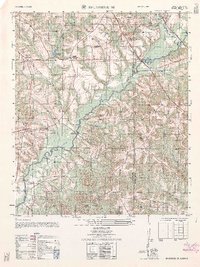
1962 Map of Brundidge SE
USGS Topo · Published 1962About this map
Pea River winds through the heart of this landscape at the junction of Coffee, Pike, and Dale counties. Small agricultural communities such as Tennille, Roeton, and Java are connected by a network of rural roads and crossings like Johnson's Bridge and Coles Bridge. The map captures a moment when traditional rural structures, including the Crossroad School and numerous country churches like New Salem Church and Eaton Church, served as local focal points alongside industrial features like Prestwood Mill Pond.
Find a feature on this map
40 named features on this map. Tap any name to fly to it.
Don’t see what you’re looking for? This feature index may not catch every label — zoom into the map to look around manually.
Map Details
Editions of this 1962 Brundidge SE Map
This is the sole edition of this map. No revisions or reprints were ever made.
Other maps of this area

1942 · Enterprise
USGS Topo · 1:125,000

1948 · Ozark
USGS Topo · 1:62,500

1948 · Brundidge
USGS Topo · 1:62,500

1950 · Ozark
USGS Topo · 1:62,500

1950 · Enterprise
USGS Topo · 1:62,500

1950 · Brundidge
USGS Topo · 1:62,500

1953 · Dothan
USGS Topo · 1:250,000

1954 · Dothan
USGS Topo · 1:250,000

1955 · Dothan
USGS Topo · 1:250,000

1960 · Brundidge
USGS Topo · 1:24,000