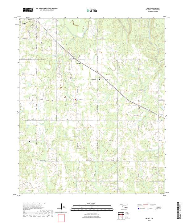
2022 Map of Bruno
USGS Topo · Published 2022About this map
Bruno sits at a crossroads in the hills of Atoka County, serving as a central point in a landscape defined by its many winding watercourses and family burial grounds. The area is dominated by the drainages of Muddy Boggy Creek and its numerous tributaries, including Sand Cr and Rock Cr. Cultural history is prominently preserved through several scattered cemeteries such as Harmony Cem, Buffalo Creek Cem, and Bethany Cem, which often represent the locations of early community focal points or former church sites. The terrain features local landmarks like Scratch Hill in the northwest, while the road network follows section lines and natural ridges, connecting remote properties via routes like Trevor Bend Rd and Buffalo Creek Rd. This survey captures the rural character of southeastern Oklahoma, showing a persistent pattern of small-scale agriculture and dispersed settlement near reliable water sources like Sawmill Spr and Double Springs Cr.
Find a feature on this map
61 named features on this map. Tap any name to fly to it.
Don’t see what you’re looking for? This feature index may not catch every label — zoom into the map to look around manually.
Map Details
Editions of this 2022 Bruno Map
This is the sole edition of this map. No revisions or reprints were ever made.
Other maps of this area

1899 · Atoka
USGS Topo · 1:125,000

1900 · Atoka
USGS Topo · 1:125,000

1901 · Antlers
USGS Topo · 1:125,000

1912 · Antlers
USGS Topo · 1:125,000

1925 · Antlers
USGS Topo · 1:125,000

1950 · Mcalester
USGS Topo · 1:250,000

1956 · Stringtown
USGS Topo · 1:24,000

1957 · Lane NW
USGS Topo · 1:24,000

1957 · Lehigh
USGS Topo · 1:24,000

1957 · Bruno
USGS Topo · 1:24,000