
1956 Map of Stringtown
USGS Topo · Published 1958About this map
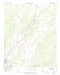
Missouri Kansas Texas railroad tracks parallel the Black Knob Ridge through this mid-century portrait of southeastern Oklahoma. The landscape is defined by the convergence of major waterways, including North Boggy Creek and Muddy Boggy Creek, which carve through the terrain near the settlements of Stringtown and Atoka. The presence of the Confederate Cemetery and McKinney Cemetery provides a tangible link to 19th-century history, while the West Tellico Sch (Abandoned) reflects shifts in rural education patterns by the 1950s.
Find a feature on this map
34 named features on this map. Tap any name to fly to it.
Don’t see what you’re looking for? This feature index may not catch every label — zoom into the map to look around manually.
Map Details
Editions of this 1956 Stringtown Map
4 editions found
Other maps of this area

1896 · Coalgate
USGS Topo · 1:125,000

1898 · McAlester
USGS Topo · 1:125,000

1899 · Coalgate
USGS Topo · 1:125,000

1899 · Atoka
USGS Topo · 1:125,000

1900 · Atoka
USGS Topo · 1:125,000

1900 · Coalgate
USGS Topo · 1:125,000

1901 · Antlers
USGS Topo · 1:125,000

1909 · Mc Alester
USGS Topo · 1:125,000

1912 · Antlers
USGS Topo · 1:125,000

1925 · Antlers
USGS Topo · 1:125,000