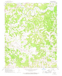
1967 Map of Bruno
USGS Topo · Published 1968About this map
Crooked Creek snakes through the northern reaches of this Marion County landscape, following the Missouri Pacific railroad line through the settlements of Pyatt and Powell. This mid-century survey illustrates a rural upland economy defined by scattered small communities and isolated homesteads. The terrain is deeply incised by drainages such as Hampton Creek and Clear Creek, which separate distinct named uplands like Blythe, Joe Burleson, and Union. Local history is anchored by several family-named burial grounds, including Patton Cem and Stanley Cem. In the southern half of the quadrangle, the more open terrain of Kings Prairie gives way to the community of Bruno, where the Bruno Cem and local school buildings mark the center of the Hampton and Independence districts. Commercial activity is represented by a Gravel Pit near Pyatt and a Quarry situated along the creek bluffs.
Find a feature on this map
32 named features on this map. Tap any name to fly to it.
Don’t see what you’re looking for? This feature index may not catch every label — zoom into the map to look around manually.
Map Details
Editions of this 1967 Bruno Map
2 editions found
Other maps of this area

1893 · Yellville
USGS Topo · 1:125,000

1903 · Yellville
USGS Topo · 1:125,000

1905 · Yellville
USGS Topo · 1:125,000

1929 · Yellville
USGS Topo · 1:125,000

1945 · Harrison
USGS Topo · 1:250,000

1949 · Harrison
USGS Topo · 1:250,000

1954 · Harrison
USGS Topo · 1:250,000

1958 · Harrison
USGS Topo · 1:250,000

1964 · Harrison
USGS Topo · 1:250,000
1966 · Yellville
USGS Topo · 1:24,000