
1962 Map of Bruno
USGS Topo · Published 1964About this map
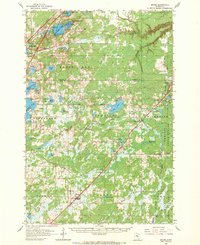
Barnum and Bruno anchor a landscape defined by the Great Northern railroad, which slices diagonally across this 1962 record of Pine and Carlton Counties. The rail line serves as the primary artery for small trackside settlements including Kerrick, Duquette, and Nickerson. Cultural life in the mid-century is marked by landmarks such as the Drive-in Theater near Barnum, Camp Wanakiwin, and the Windemere Ch. The geography is dense with glacial lakes, from the large Hanging Horn Lake and Sturgeon Lake to more remote waters like Walthausen Lake and Bartels Lake. Much of the eastern portion is dominated by the Nemadji State Forest, where the Nickerson Lookout Tower stands as a sentinel over the headwaters of the Nemadji River and Clear Creek.
Find a feature on this map
65 named features on this map. Tap any name to fly to it.
Don’t see what you’re looking for? This feature index may not catch every label — zoom into the map to look around manually.
Map Details
Editions of this 1962 Bruno Map
2 editions found
Other maps of this area

1949 · Danbury
USGS Topo · 1:48,000

1949 · Holyoke
USGS Topo · 1:48,000

1953 · Duluth
USGS Topo · 1:250,000

1954 · Wrenshall
USGS Topo · 1:24,000

1954 · Atkinson
USGS Topo · 1:24,000

1956 · Barnum
USGS Topo · 1:62,500

1958 · Duluth
USGS Topo · 1:250,000

1961 · Sandstone
USGS Topo · 1:62,500

1961 · Cromwell
USGS Topo · 1:62,500

1961 · Moose Lake
USGS Topo · 1:62,500