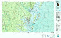
1981 Map of Brunswick
USGS Topo · Published 1993About this map
The Altamaha River Delta and its intricate network of coastal sounds dominate the landscape of the Georgia coast in the early 1980s. This survey illustrates the dense maritime and industrial geography around Brunswick, where the Turtle River and Brunswick River converge near Andrews Island. The transition from wartime use to civil administration is evident at the Glynco Naval Air Station, which is shown alongside the Federal Law Enforcement Training Center.
Find a feature on this map
109 named features on this map. Tap any name to fly to it.
Don’t see what you’re looking for? This feature index may not catch every label — zoom into the map to look around manually.
Map Details
Editions of this 1981 Brunswick Map
3 editions found
Other maps of this area

1917 · Nahunta
USGS Topo · 1:62,500

1917 · Boulogne
USGS Topo · 1:62,500

1918 · Cumberland Island
USGS Topo · 1:62,500

1918 · Jesup
USGS Topo · 1:62,500

1918 · Folkston
USGS Topo · 1:62,500

1918 · Hortense
USGS Topo · 1:62,500

1918 · Everett City
USGS Topo · 1:62,500

1918 · Nahunta
USGS Topo · 1:62,500

1918 · Bladen
USGS Topo · 1:62,500

1918 · Kingsland
USGS Topo · 1:62,500