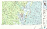
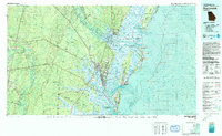
1981 Map of Brunswick
USGS Topo · Published 1993About this map
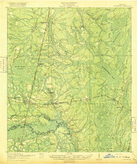
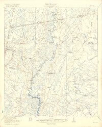
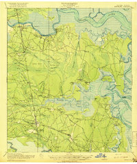
Brunswick and the surrounding coastal marshlands are depicted here during a period of established maritime and industrial activity. The intricate network of the Altama River delta dominates the landscape, where expansive wetlands and islands like Broughton Island and Rhetts Island define the transition from river to sound. The map provides a detailed view of the regional transportation infrastructure, highlighting the Seaboard Coast Line and Southern Railway corridors that serviced rural communities such as Thalmann and Sterling. Cultural and conservation sites are prominent, from the Fort Frederica National Monument on Saint Simons Island to the sprawling Richard J Reynolds State Wildlife Refuge on Sapelo Island. The presence of numerous small settlements like Gowrie Island and Brookman alongside established landmarks such as Palmetto Cem offers significant detail for those tracking the 20th-century development of Glynn and McIntosh counties.
Find a feature on this map
112 named features on this map. Tap any name to fly to it.
Don’t see what you’re looking for? This feature index may not catch every label — zoom into the map to look around manually.
Map Details
Editions of this 1981 Brunswick Map
3 editions found

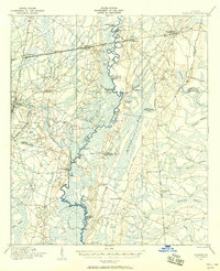
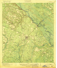
Other maps of this area
1917 · Nahunta
USGS Topo · 1:62,500

1917 · Boulogne
USGS Topo · 1:62,500

1918 · Cumberland Island
USGS Topo · 1:62,500
1918 · Jesup
USGS Topo · 1:62,500

1918 · Folkston
USGS Topo · 1:62,500
1918 · Hortense
USGS Topo · 1:62,500

1918 · Everett City
USGS Topo · 1:62,500
1918 · Nahunta
USGS Topo · 1:62,500

1918 · Bladen
USGS Topo · 1:62,500
1918 · Kingsland
USGS Topo · 1:62,500