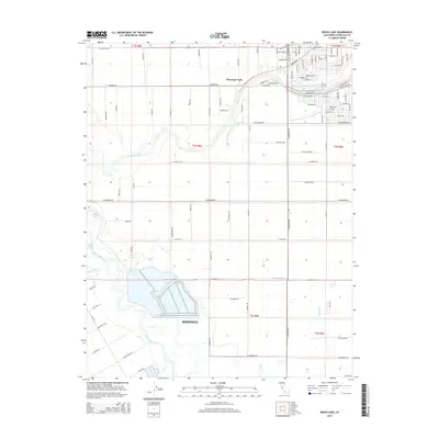
2015 Map of Brush Lake
USGS Topo · Published 2015About this map
The Tuolumne River and San Joaquin River converge in this fertile stretch of the San Joaquin Valley, creating a landscape defined by complex water management and agricultural grid patterns. In the northern reaches, the community of Riverdale Park sits along the banks of the Tuolumne, while the outskirts of Modesto extend into the central map area. The intricate network of irrigation and drainage, including Westport Drain, Hatch Drain, and the Lower Lateral Number Two and One-Half, illustrates the engineering required to sustain the region's intensive farming.
Find a feature on this map
100 named features on this map. Tap any name to fly to it.
Don’t see what you’re looking for? This feature index may not catch every label — zoom into the map to look around manually.
Map Details
Editions of this 2015 Brush Lake Map
This is the sole edition of this map. No revisions or reprints were ever made.
Other maps of this area

1915 · Ripon
USGS Topo · 1:31,680

1915 · Westport
USGS Topo · 1:31,680

1915 · Westley
USGS Topo · 1:31,680

1915 · Salida
USGS Topo · 1:31,680

1916 · Mitchell School
USGS Topo · 1:31,680

1916 · Crows Landing
USGS Topo · 1:31,680

1916 · Patterson
USGS Topo · 1:31,680

1916 · Riverbank
USGS Topo · 1:31,680

1916 · Ceres
USGS Topo · 1:31,680

1919 · Orestimba
USGS Topo · 1:62,500