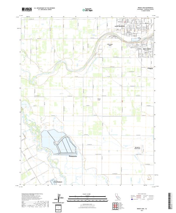
2021 Map of Brush Lake
USGS Topo · Published 2021About this map
The San Joaquin River defines the central geography of this portion of the Central Valley, winding between the growing urban outskirts of Modesto and Patterson. The landscape is a complex network of agricultural water management, evidenced by features like the Lower Lateral Number Two and One Half, Westport Drain, and Hatch Drain, which support the region's intensive farming operations. Near the river's edge, Brush Lake and Richie Slough represent the remnant natural riparian environment of the valley floor.
Find a feature on this map
111 named features on this map. Tap any name to fly to it.
Don’t see what you’re looking for? This feature index may not catch every label — zoom into the map to look around manually.
Map Details
Editions of this 2021 Brush Lake Map
This is the sole edition of this map. No revisions or reprints were ever made.
Other maps of this area

1915 · Ripon
USGS Topo · 1:31,680

1915 · Westport
USGS Topo · 1:31,680

1915 · Westley
USGS Topo · 1:31,680

1915 · Salida
USGS Topo · 1:31,680

1916 · Mitchell School
USGS Topo · 1:31,680

1916 · Crows Landing
USGS Topo · 1:31,680

1916 · Patterson
USGS Topo · 1:31,680

1916 · Riverbank
USGS Topo · 1:31,680

1916 · Ceres
USGS Topo · 1:31,680

1919 · Orestimba
USGS Topo · 1:62,500