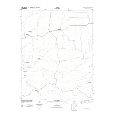
2012 Map of Brushyknob
USGS Topo · Published 2012About this map
Bryant Creek and its many tributaries, such as Planer Branch and Tarbutton Creek, dictate the geography of this Douglas County landscape. The area is characterized by a dense network of hollows, including Negro Henry Hollow, Wolfpen Hollow, and Cane Hollow, which reveal the complex drainage patterns of the Ozark Plateau. Small settlements and crossroads like Brushyknob, Coldspring, and Champion are connected by a web of county roads, showing a dispersed rural settlement pattern that persists into the early 21st century. Local history and genealogy are anchored by features such as Clever Creek Cemetery, New Hope Cemetery, and Days Springs. The southern portion of the map features the community of Sweden and the nearby Sweden Hollow, while Vera Cruz sits to the west, illustrating the enduring placenames of this Missouri region.
Find a feature on this map
57 named features on this map. Tap any name to fly to it.
Don’t see what you’re looking for? This feature index may not catch every label — zoom into the map to look around manually.
Map Details
Editions of this 2012 Brushyknob Map
This is the sole edition of this map. No revisions or reprints were ever made.
Other maps of this area

1936 · Ava
USGS Topo · 1:48,000

1937 · Buckhart
USGS Topo · 1:48,000

1942 · Ava
USGS Topo · 1:62,500

1943 · Buckhart
USGS Topo · 1:62,500

1945 · Ava
USGS Topo · 1:62,500

1945 · Harrison
USGS Topo · 1:250,000

1945 · Buckhart
USGS Topo · 1:62,500

1949 · Harrison
USGS Topo · 1:250,000

1951 · Norwood
USGS Topo · 1:24,000

1951 · Mountain Grove South
USGS Topo · 1:24,000