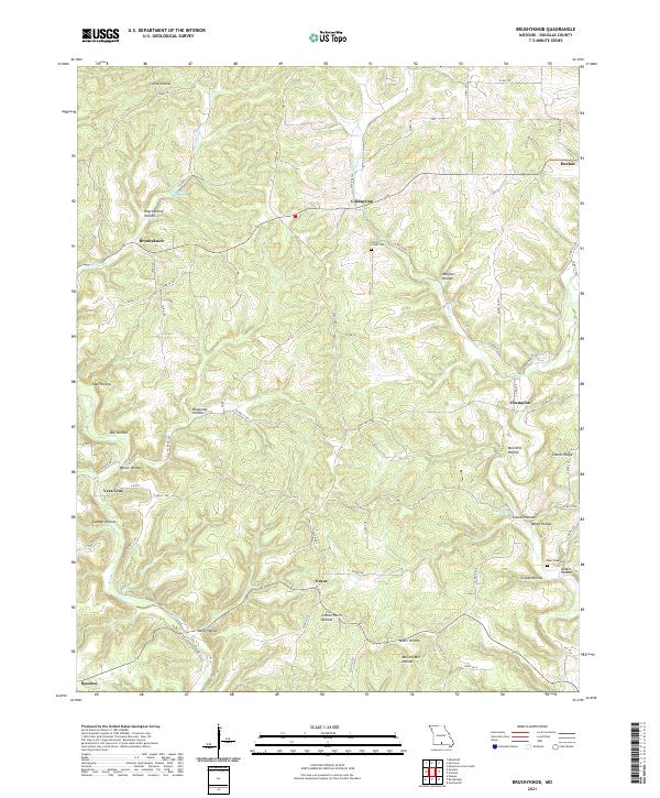
2021 Map of Brushyknob
USGS Topo · Published 2021About this map
Bryant Creek and its tributary Tarbutton Cr carve a landscape of deep hollows and high ridges across this Douglas County quadrangle. Small Missouri settlements like Brushyknob, Coldspring, and Champion are connected by a network of county roads that navigate the complex topography, including Coonts Ridge and Wolfpen Hollow. The map reveals a rural Ozark character where local identity is tied to specific drainages and landforms, such as Negro Henry Hollow and Bluegrass Hollow.
Find a feature on this map
75 named features on this map. Tap any name to fly to it.
Don’t see what you’re looking for? This feature index may not catch every label — zoom into the map to look around manually.
Map Details
Editions of this 2021 Brushyknob Map
This is the sole edition of this map. No revisions or reprints were ever made.
Other maps of this area

1936 · Ava
USGS Topo · 1:48,000

1937 · Buckhart
USGS Topo · 1:48,000

1942 · Ava
USGS Topo · 1:62,500

1943 · Buckhart
USGS Topo · 1:62,500

1945 · Ava
USGS Topo · 1:62,500

1945 · Harrison
USGS Topo · 1:250,000

1945 · Buckhart
USGS Topo · 1:62,500

1949 · Harrison
USGS Topo · 1:250,000

1951 · Norwood
USGS Topo · 1:24,000

1951 · Mountain Grove South
USGS Topo · 1:24,000