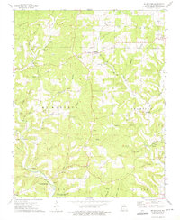
1973 Map of Brushyknob
USGS Topo · Published 1975About this map
Bryant Creek winds through the southwestern corner of this Ozark landscape, anchoring a rural territory defined by deeply etched hollows and ridges during the early 1970s. The settlement pattern is scattered among several historic communities including Vera Cruz, Champion, and Denlow, each serving as a local focal point for the surrounding farmsteads and timber tracts. The area is heavily intersected by named drainage systems like Bluegrass Creek and Wilson Creek, with numerous springs such as the Callaway Riley Spring providing essential water sources for the upland residents.
Find a feature on this map
42 named features on this map. Tap any name to fly to it.
Don’t see what you’re looking for? This feature index may not catch every label — zoom into the map to look around manually.
Map Details
Editions of this 1973 Brushyknob Map
This is the sole edition of this map. No revisions or reprints were ever made.
Other maps of this area

1936 · Ava
USGS Topo · 1:48,000

1937 · Buckhart
USGS Topo · 1:48,000

1942 · Ava
USGS Topo · 1:62,500

1943 · Buckhart
USGS Topo · 1:62,500

1945 · Ava
USGS Topo · 1:62,500

1945 · Harrison
USGS Topo · 1:250,000

1945 · Buckhart
USGS Topo · 1:62,500

1949 · Harrison
USGS Topo · 1:250,000

1951 · Norwood
USGS Topo · 1:24,000

1951 · Mountain Grove South
USGS Topo · 1:24,000