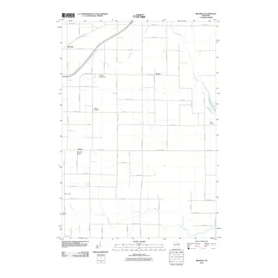
2010 Map of Brussels
USGS Topo · Published 2010About this map
The Niagara Escarpment runs through this portion of Door County, creating a distinct geological break in the landscape north of Brussels. This 2010 survey shows a rural Wisconsin landscape defined by small crossroads settlements and a meticulous grid of named roads, many bearing family and avian names. In the southern reach, Rosiere serves as a local anchor near Saint Huberts Catholic Cemetery, while the northern area is characterized by the meandering Ahnapee River and Silver Creek. The presence of Saint Michaels Cemetery and Woller Cemetery provides specific points of interest for genealogists tracing local families in this agricultural region. The map also captures several water features including Forestville Flowage 40 and Bruemmer Creek, which navigate the terrain alongside the prominent rise of Dhuey Hill.
Find a feature on this map
60 named features on this map. Tap any name to fly to it.
Don’t see what you’re looking for? This feature index may not catch every label — zoom into the map to look around manually.
Map Details
Editions of this 2010 Brussels Map
This is the sole edition of this map. No revisions or reprints were ever made.
Other maps of this area

1952 · Casco
USGS Topo · 1:62,500

1954 · Manitowoc
USGS Topo · 1:250,000

1958 · Manitowoc
USGS Topo · 1:250,000

1960 · Sturgeon Bay
USGS Topo · 1:62,500

1960 · Algoma
USGS Topo · 1:62,500

1961 · Little Sturgeon
USGS Topo · 1:62,500

1978 · Casco
USGS Topo · 1:24,000

1978 · Namur
USGS Topo · 1:24,000
1978 · Luxemburg
USGS Topo · 1:24,000

1978 · Brussels
USGS Topo · 1:24,000