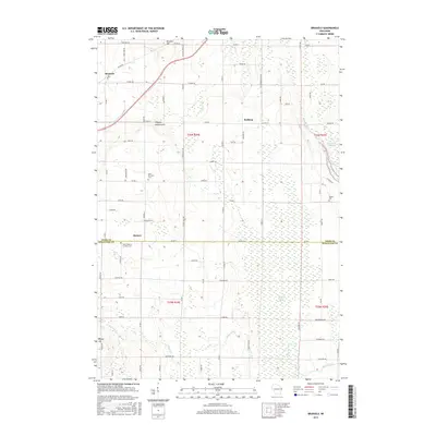
2015 Map of Brussels
USGS Topo · Published 2015About this map
Brussels Hill and the prominent Niagara Escarpment define the geography of this northern Wisconsin landscape, where the boundary between Door Co and Kewaunee Co bisects local townships. The settlement of Brussels serves as a primary hub, while the smaller hamlets of Kolberg and Rosiere anchor the surrounding agricultural and wooded lands. Genealogists and local researchers will find several notable burial sites throughout the quadrangle, including Saint Huberts Catholic Cem, Saint Michaels Cem, and the Woller Cem.
Find a feature on this map
75 named features on this map. Tap any name to fly to it.
Don’t see what you’re looking for? This feature index may not catch every label — zoom into the map to look around manually.
Map Details
Editions of this 2015 Brussels Map
This is the sole edition of this map. No revisions or reprints were ever made.
Other maps of this area

1952 · Casco
USGS Topo · 1:62,500

1954 · Manitowoc
USGS Topo · 1:250,000

1958 · Manitowoc
USGS Topo · 1:250,000

1960 · Sturgeon Bay
USGS Topo · 1:62,500

1960 · Algoma
USGS Topo · 1:62,500

1961 · Little Sturgeon
USGS Topo · 1:62,500

1978 · Casco
USGS Topo · 1:24,000

1978 · Namur
USGS Topo · 1:24,000
1978 · Luxemburg
USGS Topo · 1:24,000

1978 · Brussels
USGS Topo · 1:24,000