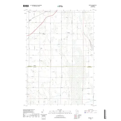
2018 Map of Brussels
USGS Topo · Published 2018About this map
The Niagara Escarpment defines the geological character of this region, shaping the high ground of Brussels Hill and Dhuey Hill. Located on the border of Door and Kewaunee counties, this landscape is a patchwork of agricultural plots and low-lying wetlands like the Black Ash Swamp. Small communities and religious centers serve as the primary landmarks, including the settlement of Brussels and the Saint Huberts Catholic Cem in Rosiere. The road network follows a rigid grid system typical of the Midwest, though it frequently yields to the winding course of the Ahnapee River and several branches of Silver Creek. This map offers a modern view of a rural Wisconsin corridor where the drainage patterns of the Bruemmer Cr and the heights of the escarpment continue to dictate the placement of farms and small hamlets like Kolberg.
Find a feature on this map
72 named features on this map. Tap any name to fly to it.
Don’t see what you’re looking for? This feature index may not catch every label — zoom into the map to look around manually.
Map Details
Editions of this 2018 Brussels Map
This is the sole edition of this map. No revisions or reprints were ever made.
Other maps of this area

1952 · Casco
USGS Topo · 1:62,500

1954 · Manitowoc
USGS Topo · 1:250,000

1958 · Manitowoc
USGS Topo · 1:250,000

1960 · Sturgeon Bay
USGS Topo · 1:62,500

1960 · Algoma
USGS Topo · 1:62,500

1961 · Little Sturgeon
USGS Topo · 1:62,500

1978 · Casco
USGS Topo · 1:24,000

1978 · Namur
USGS Topo · 1:24,000
1978 · Luxemburg
USGS Topo · 1:24,000

1978 · Brussels
USGS Topo · 1:24,000