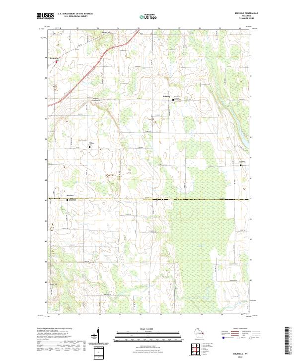
2022 Map of Brussels
USGS Topo · Published 2022About this map
The Niagara Escarpment defines the geological character of this section of the Door Peninsula, where agricultural lands meet the distinct ridge line. In the northern portion of the map, the settlement of Brussels is situated near Brussels Hill, while the village of Kolberg sits further east, anchored by the Emmanuel Lutheran Church. The landscape is dotted with several significant local burial grounds, including Saint Francis Cem and Saint Michaels Cem, which serve as vital markers for genealogical research in these long-established Belgian and German communities. To the south, the village of Rosiere straddles the line between Door and Kewaunee counties, home to Saint Huberts Catholic Cem. Waterways like the Ahnapee River and the expansive Black Ash Swamp highlight the drainage patterns of the peninsula, while named elevations such as Dhuey Hill break the otherwise steady agricultural grid.
Find a feature on this map
77 named features on this map. Tap any name to fly to it.
Don’t see what you’re looking for? This feature index may not catch every label — zoom into the map to look around manually.
Map Details
Editions of this 2022 Brussels Map
This is the sole edition of this map. No revisions or reprints were ever made.
Other maps of this area

1952 · Casco
USGS Topo · 1:62,500

1954 · Manitowoc
USGS Topo · 1:250,000

1958 · Manitowoc
USGS Topo · 1:250,000

1960 · Sturgeon Bay
USGS Topo · 1:62,500

1960 · Algoma
USGS Topo · 1:62,500

1961 · Little Sturgeon
USGS Topo · 1:62,500

1978 · Casco
USGS Topo · 1:24,000

1978 · Namur
USGS Topo · 1:24,000
1978 · Luxemburg
USGS Topo · 1:24,000

1978 · Brussels
USGS Topo · 1:24,000