
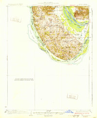
1931 Map of Brussels
USGS Topo · Published 1931About this map
The Illinois River and Mississippi River converge at the tip of Calhoun County, defining a landscape dominated by river transport and fertile bottomlands during the early 1930s. The interior ridge is dotted with local institutions like Western Sch, Liberty Sch, and Conrad Sch, while the shoreline is lined with essential steamboat landings such as Dogtown Ldg, Beech Ldg, and Dixon Ldg. Small inland communities including Brussels, Meppen, and Beechville serve as hubs for the surrounding farmsteads.
Find a feature on this map
65 named features on this map. Tap any name to fly to it.
Don’t see what you’re looking for? This feature index may not catch every label — zoom into the map to look around manually.
Map Details
Editions of this 1931 Brussels Map
2 editions found
Other maps of this area

1903 · O'Fallon
USGS Topo · 1:125,000

1924 · Robertson
USGS Topo · 1:24,000

1927 · St. Charles
USGS Topo · 1:62,500

1930 · Hardin
USGS Topo · 1:62,500

1930 · Jerseyville
USGS Topo · 1:62,500

1932 · Manchester NE
USGS Topo · 1:24,000

1933 · Creve Coeur
USGS Topo · 1:24,000

1933 · Jerseyville
USGS Topo · 1:62,500

1933 · Saint Charles
USGS Topo · 1:62,500

1934 · Elsberry
USGS Topo · 1:48,000