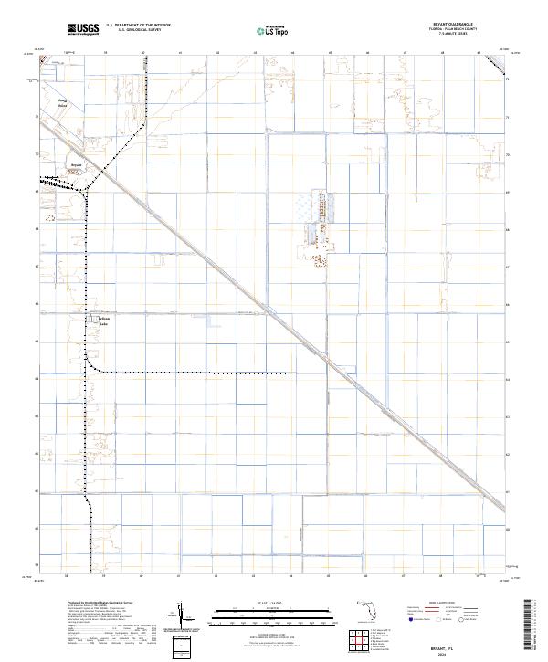
2024 Map of Bryant
USGS Topo · Published 2024About this map
Canal Point and the neighboring settlement of Bryant occupy the northwestern corner of this territory, where the infrastructure of Florida's agricultural interior meets the edge of the Everglades. The landscape is dominated by the diagonal corridor of the West Palm Beach Canal, a primary waterway that historically facilitated the drainage and development of the region's rich muck soils. The map illustrates a highly organized grid of land divisions and agricultural fields, intersected by industrial-age roads such as Muck City Rd and Old Conners Rd. Near the western edge, Pelican Lake provides a natural break in the geometric patterns of the sugar and vegetable fields. This modern survey reflects the enduring importance of water management systems, showcasing how the network of canals and dikes continues to define the geography of Palm Beach County.
Find a feature on this map
14 named features on this map. Tap any name to fly to it.
Don’t see what you’re looking for? This feature index may not catch every label — zoom into the map to look around manually.
Map Details
Editions of this 2024 Bryant Map
This is the sole edition of this map. No revisions or reprints were ever made.
Other maps of this area

1956 · West Palm Beach
USGS Topo · 1:250,000

1957 · West Palm Beach
USGS Topo · 1:250,000

1958 · West Palm Beach
USGS Topo · 1:250,000

1970 · Belle Glade
USGS Topo · 1:24,000

1970 · West Palm Beach 2 SW
USGS Topo · 1:24,000

1970 · Loxahatchee NW
USGS Topo · 1:24,000

1970 · Pahokee
USGS Topo · 1:24,000

1970 · Bryant
USGS Topo · 1:24,000

1970 · Sixmile Bend
USGS Topo · 1:24,000
1970 · West Palm Beach 2 NW
USGS Topo · 1:24,000