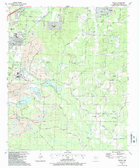
1987 Map of Bryant
USGS Topo · Published 1987About this map
Extensive mining operations dominate the western landscape of this mid-1980s Saline County survey, marked by numerous Mine sites, Tailings Ponds, and a large Mine Dump near Bryant. The industrial character of the region is further defined by the Bauxite & Northern RR and several water treatment facilities. Despite this industrial footprint, established communities like Woodland Hills and Shannon Hills sit alongside rural outposts such as Sardis and Vimy Ridge.
Find a feature on this map
60 named features on this map. Tap any name to fly to it.
Don’t see what you’re looking for? This feature index may not catch every label — zoom into the map to look around manually.
Map Details
Editions of this 1987 Bryant Map
2 editions found
Other maps of this area

1890 · Benton
USGS Topo · 1:125,000

1891 · Little Rock
USGS Topo · 1:125,000

1893 · Little Rock
USGS Topo · 1:125,000

1894 · Benton
USGS Topo · 1:125,000

1935 · Little Rock
USGS Topo · 1:24,000

1935 · Alexander
USGS Topo · 1:48,000

1938 · Benton
USGS Topo · 1:48,000

1941 · Alexander
USGS Topo · 1:62,500

1944 · Benton
USGS Topo · 1:62,500

1944 · Alexander
USGS Topo · 1:31,680