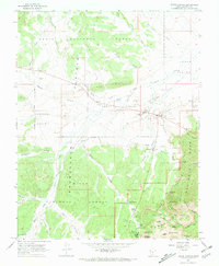
1966 Map of Bryce Canyon
USGS Topo · Published 1968About this map
The Paunsaugunt Plateau and Emery Valley define this mid-1960s landscape, where high-altitude ranching and nascent tourism converged. Near the entrance to Bryce Canyon National Park, Rubys Inn stands as a focal point for the region's development. The map meticulously documents the transition from the forested heights of the Dixie National Forest to the dramatic formations of the Pink Cliffs, revealing a terrain managed for both conservation and utility.
Find a feature on this map
56 named features on this map. Tap any name to fly to it.
Don’t see what you’re looking for? This feature index may not catch every label — zoom into the map to look around manually.
Map Details
Editions of this 1966 Bryce Canyon Map
This is the sole edition of this map. No revisions or reprints were ever made.
Other maps of this area

1886 · Kanab
USGS Topo · 1:250,000

1953 · Cedar City
USGS Topo · 1:250,000

1958 · Cedar City
USGS Topo · 1:250,000

1962 · Cedar City
USGS Topo · 1:250,000
1966 · Cannonville
USGS Topo · 1:24,000

1966 · Wilson Peak
USGS Topo · 1:24,000
1966 · Tropic Canyon
USGS Topo · 1:24,000
1966 · Tropic Reservoir
USGS Topo · 1:24,000
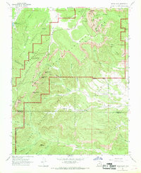
1966 · Bryce Point
USGS Topo · 1:24,000
1971 · Flake Mtn East
USGS Topo · 1:24,000