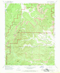
1966 Map of Bryce Point
USGS Topo · Published 1969About this map
The Pink Cliffs of southern Utah create a striking geological divide on this 1960s survey, separating the high Paunsaugunt Plateau from the intricate erosional features below. Within Bryce Canyon National Park, the map identifies famous spires and formations including the Wall of Windows, the Fairy Castle, and the dramatic Silent City. This era of the park reflects established recreational infrastructure, from the Sunset Campground to scenic overlooks like Inspiration Point and Paria View.
Find a feature on this map
66 named features on this map. Tap any name to fly to it.
Don’t see what you’re looking for? This feature index may not catch every label — zoom into the map to look around manually.
Map Details
Editions of this 1966 Bryce Point Map
2 editions found
Other maps of this area

1886 · Kanab
USGS Topo · 1:250,000

1953 · Cedar City
USGS Topo · 1:250,000

1958 · Cedar City
USGS Topo · 1:250,000

1962 · Cedar City
USGS Topo · 1:250,000
1966 · Bull Valley Gorge
USGS Topo · 1:24,000
1966 · Cannonville
USGS Topo · 1:24,000

1966 · Wilson Peak
USGS Topo · 1:24,000
1966 · Bryce Canyon
USGS Topo · 1:24,000
1966 · Podunk Creek
USGS Topo · 1:24,000
1966 · Tropic Canyon
USGS Topo · 1:24,000