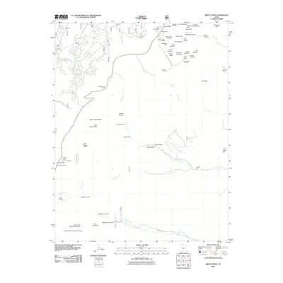
2011 Map of Bryce Point
USGS Topo · Published 2011About this map
Bryce Canyon defines this portion of the Utah landscape, characterized by an intricate network of geological formations and remote ranching outposts. The map documents the complex erosional features of the Bryce Amphitheater, where labels like Silent City, The Cathedral, and Wall of Windows identify specific landmarks within the hoodoos. Outside the canyon rim, the terrain transitions into the drainages of East Creek and Sheep Creek, revealing a different side of the region’s geography. Cultural history is anchored by sites such as Johnson Mill and the Merrill Ranch, which speak to the area's agricultural and industrial utility beyond its famous geological formations. This 2011 survey captures the intersection of natural monument preservation and private land use in Garfield County, mapping both the trails near Sunset Point and the backcountry expanses of Heward Creek.
Find a feature on this map
65 named features on this map. Tap any name to fly to it.
Don’t see what you’re looking for? This feature index may not catch every label — zoom into the map to look around manually.
Map Details
Editions of this 2011 Bryce Point Map
This is the sole edition of this map. No revisions or reprints were ever made.
Other maps of this area
1886 · Kanab
USGS Topo · 1:250,000
1953 · Cedar City
USGS Topo · 1:250,000
1958 · Cedar City
USGS Topo · 1:250,000
1962 · Cedar City
USGS Topo · 1:250,000
1966 · Bull Valley Gorge
USGS Topo · 1:24,000
1966 · Cannonville
USGS Topo · 1:24,000
1966 · Wilson Peak
USGS Topo · 1:24,000
1966 · Bryce Canyon
USGS Topo · 1:24,000
1966 · Podunk Creek
USGS Topo · 1:24,000
1966 · Tropic Canyon
USGS Topo · 1:24,000