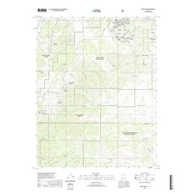
2020 Map of Bryce Point
USGS Topo · Published 2020About this map
Tropic stands at the eastern edge of a high-altitude landscape where the complex geology of Bryce Canyon National Park meets the vast reaches of Dixie National Forest and Grand Staircase-Escalante National Monument. The map documents a high density of named rock formations and landmarks along the canyon rim, including Silent City, Thors Hammer, and Gullivers Castle. These features illustrate the erosion patterns of the Pink Cliffs, while the inclusion of the Under The Rim Trail and Peekaboo Canyon Trail shows the established network of backcountry access through the amphitheaters and hoodoos.
Find a feature on this map
88 named features on this map. Tap any name to fly to it.
Don’t see what you’re looking for? This feature index may not catch every label — zoom into the map to look around manually.
Map Details
Editions of this 2020 Bryce Point Map
This is the sole edition of this map. No revisions or reprints were ever made.
Other maps of this area
1886 · Kanab
USGS Topo · 1:250,000
1953 · Cedar City
USGS Topo · 1:250,000
1958 · Cedar City
USGS Topo · 1:250,000
1962 · Cedar City
USGS Topo · 1:250,000
1966 · Bull Valley Gorge
USGS Topo · 1:24,000
1966 · Cannonville
USGS Topo · 1:24,000
1966 · Wilson Peak
USGS Topo · 1:24,000
1966 · Bryce Canyon
USGS Topo · 1:24,000
1966 · Podunk Creek
USGS Topo · 1:24,000
1966 · Tropic Canyon
USGS Topo · 1:24,000