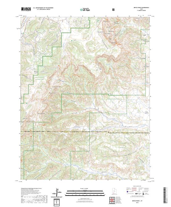
2023 Map of Bryce Point
USGS Topo · Published 2023About this map
Tropic stands on the eastern edge of this high-altitude landscape, where the plateau drops away into a complex of erosion-carved canyons and spires. This modern survey illustrates the intricate interface between Bryce Canyon National Park, Dixie National Forest, and the Grand Staircase-Escalante National Monument. The map records a dense network of geological landmarks and recreational routes, including the Under The Rim Trl and the Swamp Canyon Loop Trl. From the heights of Inspiration Point and Sunset Point, the land descends through Peek-A-Boo Canyon and past monumental formations such as The Cathedral and Liberty Castle. Further south, the terrain is defined by the headwaters of Willis Creek and Heward Creek, which drain toward the Garfield and Kane county line. The presence of Fairview Natural Bridge and Noon Canyon Butte emphasizes the geological diversity preserved within these federal lands.
Find a feature on this map
73 named features on this map. Tap any name to fly to it.
Don’t see what you’re looking for? This feature index may not catch every label — zoom into the map to look around manually.
Map Details
Editions of this 2023 Bryce Point Map
This is the sole edition of this map. No revisions or reprints were ever made.
Other maps of this area

1886 · Kanab
USGS Topo · 1:250,000

1953 · Cedar City
USGS Topo · 1:250,000

1958 · Cedar City
USGS Topo · 1:250,000

1962 · Cedar City
USGS Topo · 1:250,000
1966 · Bull Valley Gorge
USGS Topo · 1:24,000
1966 · Cannonville
USGS Topo · 1:24,000

1966 · Wilson Peak
USGS Topo · 1:24,000
1966 · Bryce Canyon
USGS Topo · 1:24,000
1966 · Podunk Creek
USGS Topo · 1:24,000
1966 · Tropic Canyon
USGS Topo · 1:24,000