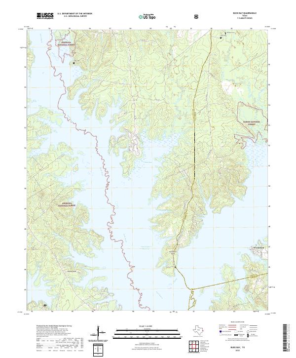
2022 Map of Buck Bay
USGS Topo · Published 2022About this map
Sam Rayburn Reservoir dominates the center of this landscape, its expansive waters defining the boundaries where Angelina National Forest and Sabine National Forest meet. The winding course of Ayish Bayou feeds into the reservoir from the north, creating a complex shoreline of inlets and points such as Needmore Point and Powell Point. This intersection of deep East Texas timberland and significant water management infrastructure highlights the 21st-century character of the region, where recreational geography overlays older timber and family lands.
Find a feature on this map
60 named features on this map. Tap any name to fly to it.
Don’t see what you’re looking for? This feature index may not catch every label — zoom into the map to look around manually.
Map Details
Editions of this 2022 Buck Bay Map
This is the sole edition of this map. No revisions or reprints were ever made.
Other maps of this area

1953 · Alexandria
USGS Topo · 1:250,000

1953 · Palestine
USGS Topo · 1:250,000

1955 · Alexandria
USGS Topo · 1:250,000

1957 · Palestine
USGS Topo · 1:250,000

1957 · Brookeland
USGS Topo · 1:62,500

1958 · Hemphill
USGS Topo · 1:62,500

1958 · Mc Gee Bend
USGS Topo · 1:62,500

1958 · Bronson
USGS Topo · 1:62,500

1969 · Brookeland
USGS Topo · 1:62,500
1984 · Harrisburg
USGS Topo · 1:24,000