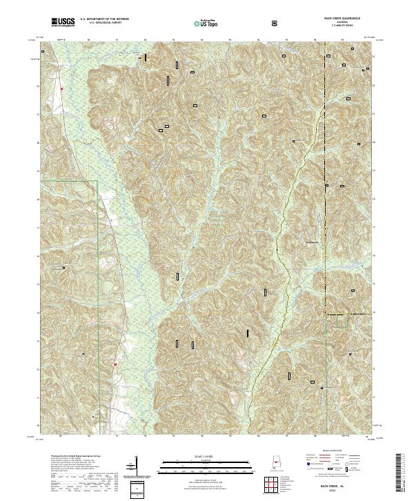
2024 Map of Buck Creek
USGS Topo · Published 2024About this map
Talladega National Forest encompasses much of this landscape in Perry and Chilton counties, where the terrain is defined by the winding drainages of Oakmulgee Creek and Little Oakmulgee Creek. The small community of Panhandle sits on the eastern side of the forest, serving as a landmark for a region where settlement is primarily marked by a network of rural roads and ancestral burial grounds.
Find a feature on this map
52 named features on this map. Tap any name to fly to it.
Don’t see what you’re looking for? This feature index may not catch every label — zoom into the map to look around manually.
Map Details
Editions of this 2024 Buck Creek Map
This is the sole edition of this map. No revisions or reprints were ever made.
Other maps of this area

1891 · Clanton
USGS Topo · 1:125,000

1953 · Montgomery
USGS Topo · 1:250,000

1956 · Montgomery
USGS Topo · 1:250,000

1957 · Montgomery
USGS Topo · 1:250,000

1959 · Plantersville
USGS Topo · 1:62,500

1959 · Summerfield
USGS Topo · 1:62,500

1971 · Maplesville West
USGS Topo · 1:24,000

1975 · Summerfield SW
USGS Topo · 1:24,000
1975 · Plantersville SW
USGS Topo · 1:24,000
1975 · Summerfield SE
USGS Topo · 1:24,000