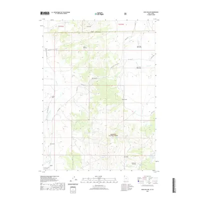
2020 Map of Buck Hollow
USGS Topo · Published 2020About this map
The settlement of Lynn and the nearby Junction Cem sit at the southern edge of this high-elevation landscape along the border of Utah and Idaho. Located in the northern reaches of Box Elder County, the area is defined by the dramatic meeting of the Albion Mountains and the Raft River Mountains, which frame the high-altitude Upper Raft River Valley. The hydrology of the region is complex, with numerous drainages like the Raft River and Junction Cr carving through the terrain, while reliable water sources such as Boundary Spring and Lynn Spring have historically supported the sparse ranching and forestry operations in this corner of the Sawtooth National Forest. A network of gravel and dirt routes, including Lynn-Almo Rd and Yost Flats Rd, connects the small community to the surrounding basins and the Upper Narrows.
Find a feature on this map
41 named features on this map. Tap any name to fly to it.
Don’t see what you’re looking for? This feature index may not catch every label — zoom into the map to look around manually.
Map Details
Editions of this 2020 Buck Hollow Map
This is the sole edition of this map. No revisions or reprints were ever made.
Other maps of this area

1954 · Pocatello
USGS Topo · 1:250,000

1954 · Brigham City
USGS Topo · 1:250,000

1958 · Pocatello
USGS Topo · 1:250,000

1958 · Brigham City
USGS Topo · 1:250,000

1959 · Cotton Thomas Basin
USGS Topo · 1:62,500

1959 · Yost
USGS Topo · 1:62,500

1962 · Brigham City
USGS Topo · 1:250,000

1968 · Almo
USGS Topo · 1:24,000

1968 · Jim Sage Canyon
USGS Topo · 1:24,000

1968 · Lyman Pass
USGS Topo · 1:24,000