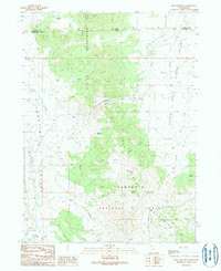
1990 Map of Buck Hollow
USGS Topo · Published 1990About this map
The Albion Mountains and Cedar Mountains dominate this high-desert landscape along the Idaho-Utah border. The terrain is characterized by a complex network of seasonal and perennial water sources, including the Raft River and its northern reaches near the Upper Narrows River. Within the southern portion of the map, the Sawtooth National Forest encompasses the rugged elevations of the Sawtooth National Forest Mountains, where numerous springs like Lynn Spring and Pine Spring provide vital water in an otherwise arid environment. Small-scale industrial activity is evidenced by a Quarry and Gravel Pit, reflecting the area's resource-based activities. The presence of named drainages such as Junction Creek and Buck Hollow suggests a landscape shaped by intermittent flows and a long history of ranching or passage through these mountain gaps.
Find a feature on this map
32 named features on this map. Tap any name to fly to it.
Don’t see what you’re looking for? This feature index may not catch every label — zoom into the map to look around manually.
Map Details
Editions of this 1990 Buck Hollow Map
This is the sole edition of this map. No revisions or reprints were ever made.
Other maps of this area

1954 · Pocatello
USGS Topo · 1:250,000

1954 · Brigham City
USGS Topo · 1:250,000

1958 · Pocatello
USGS Topo · 1:250,000

1958 · Brigham City
USGS Topo · 1:250,000

1959 · Cotton Thomas Basin
USGS Topo · 1:62,500

1959 · Yost
USGS Topo · 1:62,500

1962 · Brigham City
USGS Topo · 1:250,000

1968 · Almo
USGS Topo · 1:24,000

1968 · Jim Sage Canyon
USGS Topo · 1:24,000

1968 · Lyman Pass
USGS Topo · 1:24,000