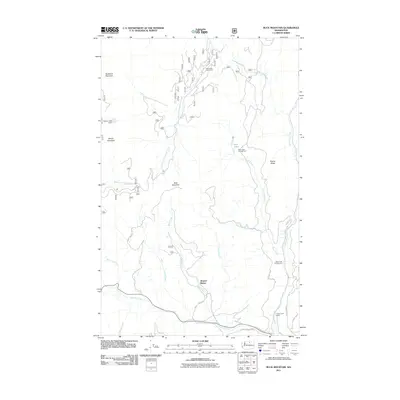
2011 Map of Buck Mountain
USGS Topo · Published 2011About this map
Buck Mountain and the surrounding highlands of Okanogan County are defined by a network of forest roads and alpine drainages. The settlement of Mowich Illahee sits near the junction of Sweat Creek and Summit Creek, serving as a central point in a landscape otherwise dedicated to recreation and water management. Early 21st-century infrastructure is visible in the presence of Loup Loup Dam and Beaver Lake Dam, while the State Road Cabin Camp near the South Fork Salmon Creek reflects the area's long-standing role as a base for mountain activities. Multiple campgrounds, including Rock Lakes Campground and Rock Creek Campground, are positioned near Ritchie Ridge and the various forks of Rock Creek, illustrating how the peaks of McDaniel Mountain and Beaver Mountain provide a backdrop for local timber and recreational economies.
Find a feature on this map
29 named features on this map. Tap any name to fly to it.
Don’t see what you’re looking for? This feature index may not catch every label — zoom into the map to look around manually.
Map Details
Editions of this 2011 Buck Mountain Map
This is the sole edition of this map. No revisions or reprints were ever made.
Other maps of this area

1905 · Okanogan
USGS Topo · 1:125,000

1906 · Chopaka
USGS Topo · 1:125,000

1954 · Okanogan
USGS Topo · 1:250,000

1956 · Loup Loup
USGS Topo · 1:62,500

1956 · Tiffany Mountain
USGS Topo · 1:62,500

1957 · Okanogan
USGS Topo · 1:62,500

1957 · Conconully
USGS Topo · 1:62,500

1958 · Okanogan
USGS Topo · 1:250,000
1980 · Ruby Hill
USGS Topo · 1:24,000
1981 · Conconully East
USGS Topo · 1:24,000