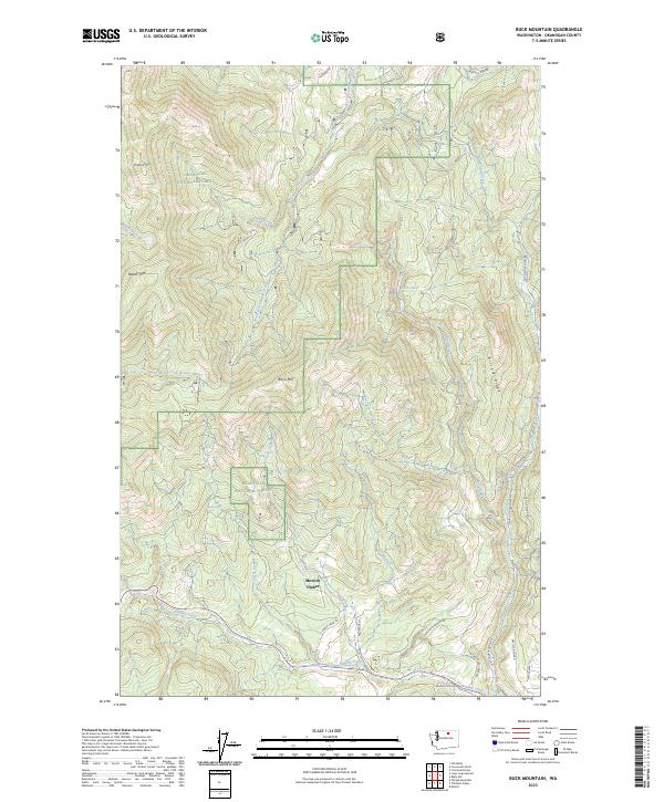
2023 Map of Buck Mountain
USGS Topo · Published 2023About this map
Mowich Illahee sits within the drainage systems of the eastern Cascades, where the terrain is defined by the high elevations of Buck Mtn and McDaniel Mtn. Located within the Okanogan National Forest, this area serves as a significant watershed for numerous local tributaries. The map details a complex network of waterways, including the South Fork Salmon Creek and Loup Loup Creek, which flow through deep valleys separated by prominent landmarks like Ritchie Ridge. The presence of Rock Lakes and Spike Spring highlights the importance of water resources in this forested landscape. A system of forest roads, such as Loup Loup Canyon Rd and Neville Ridge Rd, provides access across the ridgelines, reflecting the long-standing management of these public lands for both natural preservation and resource utilization.
Find a feature on this map
36 named features on this map. Tap any name to fly to it.
Don’t see what you’re looking for? This feature index may not catch every label — zoom into the map to look around manually.
Map Details
Editions of this 2023 Buck Mountain Map
This is the sole edition of this map. No revisions or reprints were ever made.
Other maps of this area

1905 · Okanogan
USGS Topo · 1:125,000

1906 · Chopaka
USGS Topo · 1:125,000

1954 · Okanogan
USGS Topo · 1:250,000

1956 · Loup Loup
USGS Topo · 1:62,500

1956 · Tiffany Mountain
USGS Topo · 1:62,500

1957 · Okanogan
USGS Topo · 1:62,500

1957 · Conconully
USGS Topo · 1:62,500

1958 · Okanogan
USGS Topo · 1:250,000
1980 · Ruby Hill
USGS Topo · 1:24,000
1981 · Conconully East
USGS Topo · 1:24,000