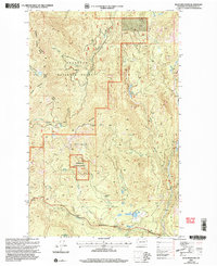
2001 Map of Buck Mountain
USGS Topo · Published 2004About this map
Buck Mountain and McDaniel Mountain dominate this section of the Okanogan National Forest, where a complex network of alpine drainages defines the topography. The landscape is marked by the high-elevation Buck Lookout and remote clearings such as Mowich Illahee and the Pixley Sportsman Park. Water is a defining element, with numerous high-country sources like Spike Spring and Squirrel Spring feeding into larger systems like Okanogan Creek and the South Fork Salmon Creek. This 2001 revision illustrates the connectivity between the peaks via the Tonasket Methaw Road and the Beaver Lake Trail, showing how land management and recreation paths navigated the drainage basins of Central Creek and DePue Creek at the start of the century.
Find a feature on this map
31 named features on this map. Tap any name to fly to it.
Don’t see what you’re looking for? This feature index may not catch every label — zoom into the map to look around manually.
Map Details
Editions of this 2001 Buck Mountain Map
This is the sole edition of this map. No revisions or reprints were ever made.
Other maps of this area

1905 · Okanogan
USGS Topo · 1:125,000

1906 · Chopaka
USGS Topo · 1:125,000

1954 · Okanogan
USGS Topo · 1:250,000

1956 · Loup Loup
USGS Topo · 1:62,500

1956 · Tiffany Mountain
USGS Topo · 1:62,500

1957 · Okanogan
USGS Topo · 1:62,500

1957 · Conconully
USGS Topo · 1:62,500

1958 · Okanogan
USGS Topo · 1:250,000
1980 · Ruby Hill
USGS Topo · 1:24,000
1981 · Conconully East
USGS Topo · 1:24,000