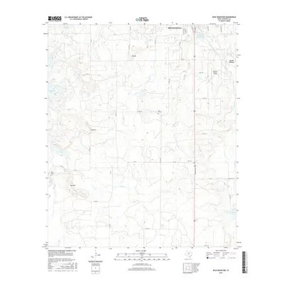
2016 Map of Buck Mountain
USGS Topo · Published 2016About this map
Breckenridge anchors the northern edge of this North Texas survey, where the town's grid gives way to a landscape defined by significant water management and varied topography. The presence of the Petroleum Corporation of Texas Reservoir and Hubbard Cr Reservoir highlights the industrial and municipal water needs of Stephens County. The terrain is punctuated by distinct high points including Buck Mtn, Hog Mtn, and Spy Mtn, which provide natural landmarks amidst a network of ranch roads and country lanes. For those researching local family history, several burial grounds are preserved across the area, including Post Oak Cem, Hart Cem, and the Van Winkle Cem near the western boundary. The map also records the rural settlement of South Hanlon and the Stephens County Airport, illustrating the mix of traditional cattle country and modern infrastructure near the headwaters of Gunsolus Creek.
Find a feature on this map
49 named features on this map. Tap any name to fly to it.
Don’t see what you’re looking for? This feature index may not catch every label — zoom into the map to look around manually.
Map Details
Editions of this 2016 Buck Mountain Map
This is the sole edition of this map. No revisions or reprints were ever made.
Other maps of this area

1890 · Breckenridge
USGS Topo · 1:125,000

1892 · Albany
USGS Topo · 1:125,000

1893 · Albany
USGS Topo · 1:125,000

1954 · Abilene
USGS Topo · 1:250,000

1958 · Abilene
USGS Topo · 1:250,000

1958 · Breckenridge
USGS Topo · 1:24,000

1958 · Edwards Branch
USGS Topo · 1:24,000

1961 · Buck Mountain
USGS Topo · 1:24,000

1961 · Eolian
USGS Topo · 1:24,000

1965 · Indian Knoll
USGS Topo · 1:24,000