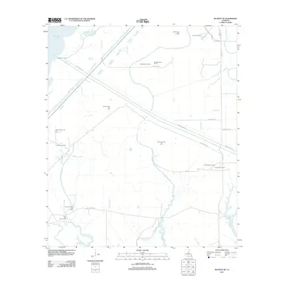
2012 Map of Buckeye NE
USGS Topo · Published 2012About this map
The Catahoula Lake Diversion Canal dominates the central topography of this Rapides Parish landscape, cutting a straight course through a complex network of natural waterways. The region is defined by its extensive energy infrastructure, with a high concentration of petroleum extraction sites including the Indian Bayou Oil Field, West Elm Ridge Oil Field, and the Muddy Bayou Oil Field. These fields are connected by a grid of specialized access roads such as Hunt Oil Rd and F Lease Rd, which navigate the low-lying wetlands.
Find a feature on this map
42 named features on this map. Tap any name to fly to it.
Don’t see what you’re looking for? This feature index may not catch every label — zoom into the map to look around manually.
Map Details
Editions of this 2012 Buckeye NE Map
This is the sole edition of this map. No revisions or reprints were ever made.
Other maps of this area

1935 · Tooleys
USGS Topo · 1:62,500

1941 · Manifest
USGS Topo · 1:62,500

1941 · Jena
USGS Topo · 1:62,500

1941 · Buckeye
USGS Topo · 1:62,500

1941 · Tooleys
USGS Topo · 1:62,500

1953 · Alexandria
USGS Topo · 1:250,000

1953 · Natchez
USGS Topo · 1:250,000

1955 · Alexandria
USGS Topo · 1:250,000

1956 · Natchez
USGS Topo · 1:250,000

1958 · Jena
USGS Topo · 1:62,500