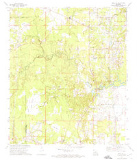
1972 Map of Buckeye
USGS Topo · Published 1974About this map
Buckeye and Deville anchor the high ground in this 1970s survey of the Rapides Parish and Avoyelles Parish border. The landscape is a complex network of prairie and bottomland, dominated by the sprawling Big Island terrain and numerous watercourses like Big Creek and Horsepen creek. The presence of an Oil Field and a Drill Hole in the northeast corner points to the region's mid-century petroleum industry, while the density of family-named cemeteries such as Bradford Cem, Paul Cem, and Slocum Cem provides a deep record of rural settlement patterns.
Find a feature on this map
53 named features on this map. Tap any name to fly to it.
Don’t see what you’re looking for? This feature index may not catch every label — zoom into the map to look around manually.
Map Details
Editions of this 1972 Buckeye Map
2 editions found
Other maps of this area

1935 · Lecompte
USGS Topo · 1:62,500

1940 · Marksville
USGS Topo · 1:62,500

1941 · Alexandria
USGS Topo · 1:62,500

1941 · Buckeye
USGS Topo · 1:62,500

1953 · Alexandria
USGS Topo · 1:250,000

1955 · Alexandria
USGS Topo · 1:250,000

1957 · Alexandria
USGS Topo · 1:62,500

1957 · Lecompte
USGS Topo · 1:62,500

1959 · Buckeye
USGS Topo · 1:62,500
1962 · Marksville
USGS Topo · 1:62,500