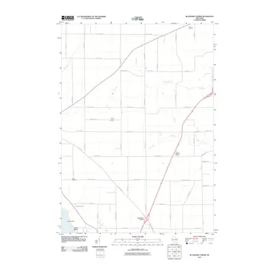
2010 Map of Buckhorn Corner
USGS Topo · Published 2010About this map
Buckhorn Corner sits at a prominent junction in this part of Dodge County, where the rural agricultural landscape is defined by a dense grid of local roads and winding waterways. The area near Trenton Center reveals a quiet history preserved in the Trenton Center Cemetery, while Marys Cemetery serves as another focal point for genealogical research. The northern reaches of the quadrangle are influenced by the proximity of Waupun Airport, while the southern edge touches upon the waterside terrain of Sunset Beach and Kirsch Island.
Find a feature on this map
44 named features on this map. Tap any name to fly to it.
Don’t see what you’re looking for? This feature index may not catch every label — zoom into the map to look around manually.
Map Details
Editions of this 2010 Buckhorn Corner Map
This is the sole edition of this map. No revisions or reprints were ever made.
Other maps of this area

1955 · Beaver Dam
USGS Topo · 1:62,500

1955 · Waupun
USGS Topo · 1:62,500

1955 · Fox Lake
USGS Topo · 1:62,500

1955 · Horicon
USGS Topo · 1:62,500

1957 · Madison
USGS Topo · 1:250,000

1960 · Madison
USGS Topo · 1:250,000

1975 · Horicon NW
USGS Topo · 1:24,000

1975 · Beaver Dam NE
USGS Topo · 1:24,000

1975 · Waupun NW
USGS Topo · 1:24,000
1975 · Waupun SW
USGS Topo · 1:24,000