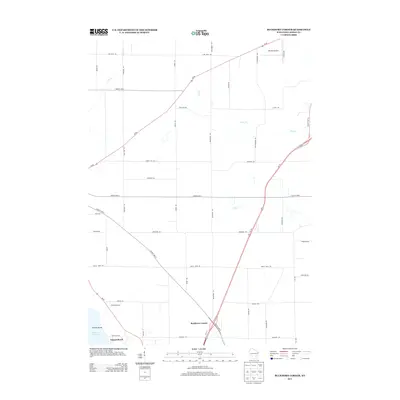
2013 Map of Buckhorn Corner
USGS Topo · Published 2013About this map
Buckhorn Corner serves as a central junction in this rural landscape, where the diagonal path of County Hwy-A meets Us-151. The map reveals a highly structured agricultural grid, defined by family and regional road names like Laurel Hill Rd and Breezy Point Rd. In the southern reaches, the land yields to the waters of Beaver Dam Lake, framing Sunset Beach and Kirsch Island. This area shows the transition from the organized farm plots of the north to the recreational shoreline at the lake's edge. To the northeast, the presence of the Waupun Airport suggests a node of regional transportation, while multiple waterways such as Plum Cr and Mill Cr drain the surrounding fields, highlighting the fundamental relationship between the local drainage patterns and the established road network of Dodge County.
Find a feature on this map
44 named features on this map. Tap any name to fly to it.
Don’t see what you’re looking for? This feature index may not catch every label — zoom into the map to look around manually.
Map Details
Editions of this 2013 Buckhorn Corner Map
This is the sole edition of this map. No revisions or reprints were ever made.
Other maps of this area

1955 · Beaver Dam
USGS Topo · 1:62,500

1955 · Waupun
USGS Topo · 1:62,500

1955 · Fox Lake
USGS Topo · 1:62,500

1955 · Horicon
USGS Topo · 1:62,500

1957 · Madison
USGS Topo · 1:250,000

1960 · Madison
USGS Topo · 1:250,000

1975 · Horicon NW
USGS Topo · 1:24,000

1975 · Beaver Dam NE
USGS Topo · 1:24,000

1975 · Waupun NW
USGS Topo · 1:24,000
1975 · Waupun SW
USGS Topo · 1:24,000