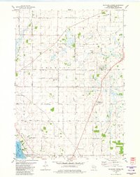
1980 Map of Buckhorn Corner
USGS Topo · Published 1981About this map
Agricultural lands and water management dominate the landscape of Trenton and Burnett townships in this 1980 survey. The rural character is defined by a dense grid of farm roads and small crossroads settlements like Trenton Center and the namesake Buckhorn Corner. Local community life is anchored by landmarks such as the Trenton Sch and the St John Ch, while the southern edge of the map reveals the northern reaches of Beaver Dam Lake.
Find a feature on this map
46 named features on this map. Tap any name to fly to it.
Don’t see what you’re looking for? This feature index may not catch every label — zoom into the map to look around manually.
Map Details
Editions of this 1980 Buckhorn Corner Map
This is the sole edition of this map. No revisions or reprints were ever made.
Other maps of this area

1955 · Beaver Dam
USGS Topo · 1:62,500

1955 · Waupun
USGS Topo · 1:62,500

1955 · Fox Lake
USGS Topo · 1:62,500

1955 · Horicon
USGS Topo · 1:62,500

1957 · Madison
USGS Topo · 1:250,000

1960 · Madison
USGS Topo · 1:250,000

1975 · Horicon NW
USGS Topo · 1:24,000

1975 · Beaver Dam NE
USGS Topo · 1:24,000

1975 · Waupun NW
USGS Topo · 1:24,000
1975 · Waupun SW
USGS Topo · 1:24,000