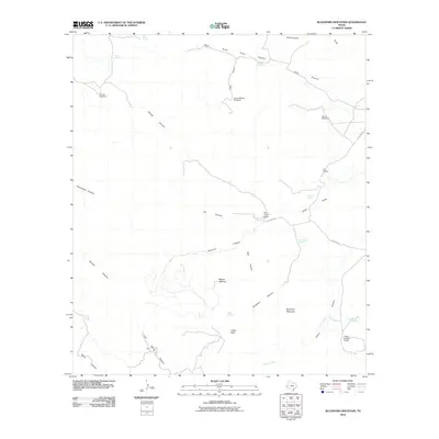
2010 Map of Buckhorn Mountain
USGS Topo · Published 2010About this map
Buckhorn Mountain and the surrounding high-desert landscape of Jeff Davis County are defined by a network of deep drainage draws and isolated ranching outposts. This 2010 survey reveals a terrain shaped by water scarcity, where life revolves around named springs like Shelberger Spring and Orchard Spring, and cattle operations are supported by mechanical landmarks such as Gomez Windmill and Leonard Camp Windmill. Significant ranching tracts including the K C Ranch and Zero Three Ranch are connected by rugged local paths like 03 Ranch Rd. The physical geography is marked by prominent elevations such as Mount McElroy and Indian Peak, which overlook complex canyon systems including Hell Canyon and Right Hand Falls Canyon. This map provides a clear record of the modern ranching infrastructure and hydrological features essential to navigating this part of the Trans-Pecos.
Find a feature on this map
33 named features on this map. Tap any name to fly to it.
Don’t see what you’re looking for? This feature index may not catch every label — zoom into the map to look around manually.
Map Details
Editions of this 2010 Buckhorn Mountain Map
This is the sole edition of this map. No revisions or reprints were ever made.
Other maps of this area

1894 · Valentine
USGS Topo · 1:125,000

1894 · Fort Davis
USGS Topo · 1:125,000

1897 · Valentine
USGS Topo · 1:125,000

1897 · Fort Davis
USGS Topo · 1:125,000

1921 · Toyah
USGS Topo · 1:125,000

1928 · Kent
USGS Topo · 1:125,000

1943 · Valentine
USGS Topo · 1:125,000

1954 · Van Horn
USGS Topo · 1:250,000

1954 · Pecos
USGS Topo · 1:250,000

1954 · Fort Stockton
USGS Topo · 1:250,000