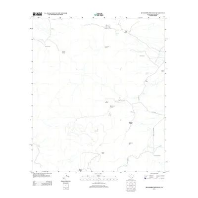
2012 Map of Buckhorn Mountain
USGS Topo · Published 2012About this map
High-altitude desert springs and ranching outposts define this corner of Jeff Davis County. Scattered across a landscape marked by Mt McElroy and Buckhorn Mtn, named water sources like Dipping Vat Spring, Shelbarger Spring, and Bear Wallow Spring indicate the essential infrastructure of West Texas cattle country. The map traces the rugged drainage systems of Hell Canyon and Solomon Canyon, which feed into the larger Buckhorn Canyon network. Human presence is concentrated at family-named operations such as the Zero Three Ranch and K C Ranch, with remote water management marked by the Gomez Windmill and Leonard Camp Windmill. This 2012 survey illustrates the enduring reliance on these isolated landmarks and private ranch roads, such as K C Ranch Rd and 03 Ranch Rd, to navigate the high-desert terrain.
Find a feature on this map
33 named features on this map. Tap any name to fly to it.
Don’t see what you’re looking for? This feature index may not catch every label — zoom into the map to look around manually.
Map Details
Editions of this 2012 Buckhorn Mountain Map
This is the sole edition of this map. No revisions or reprints were ever made.
Other maps of this area

1894 · Valentine
USGS Topo · 1:125,000

1894 · Fort Davis
USGS Topo · 1:125,000

1897 · Valentine
USGS Topo · 1:125,000

1897 · Fort Davis
USGS Topo · 1:125,000

1921 · Toyah
USGS Topo · 1:125,000

1928 · Kent
USGS Topo · 1:125,000

1943 · Valentine
USGS Topo · 1:125,000

1954 · Van Horn
USGS Topo · 1:250,000

1954 · Pecos
USGS Topo · 1:250,000

1954 · Fort Stockton
USGS Topo · 1:250,000