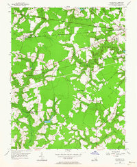
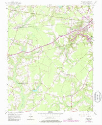
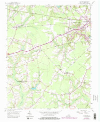
1954 Map of Buckhorn
USGS Topo · Published 1964About this map
The rail-and-swamp landscape of southern Virginia's Nansemond County is defined here by a dense concentration of railroad lines and rural congregations. Five distinct rail corridors, including the Virginian, Seaboard Air Line, and Atlantic and Danville, intersect the region, creating historic junctions like Buckhorn (Purvis Sta) and Lummis. These iron arteries navigate a complex drainage system of named wetlands, such as Quaker Swamp and Jones Swamp, which weave through the agricultural clearings. Local social life is anchored by numerous country churches and meeting houses, notably the Somerton Friends Meeting House and the Little Tabernacle. The presence of the Savage Crossing Sch and the Drive-in Theater near Kenyon illustrates the mid-century community structure, where small-scale settlements like Nurneysville and Bakers Crossing served as focal points for rural families before modern consolidation.
Find a feature on this map
32 named features on this map. Tap any name to fly to it.
Don’t see what you’re looking for? This feature index may not catch every label — zoom into the map to look around manually.
Map Details
Editions of this 1954 Buckhorn Map
6 editions found
Other maps of this area

1919 · Smithfield
USGS Topo · 1:62,500

1919 · Suffolk
USGS Topo · 1:62,500

1920 · Holland
USGS Topo · 1:62,500

1920 · Ivor
USGS Topo · 1:62,500

1943 · Holland
USGS Topo · 1:62,500

1944 · Windsor
USGS Topo · 1:31,680

1944 · Zuni
USGS Topo · 1:24,000

1945 · Zuni
USGS Topo · 1:31,680

1949 · Chuckatuck
USGS Topo · 1:24,000

1953 · Norfolk
USGS Topo · 1:250,000