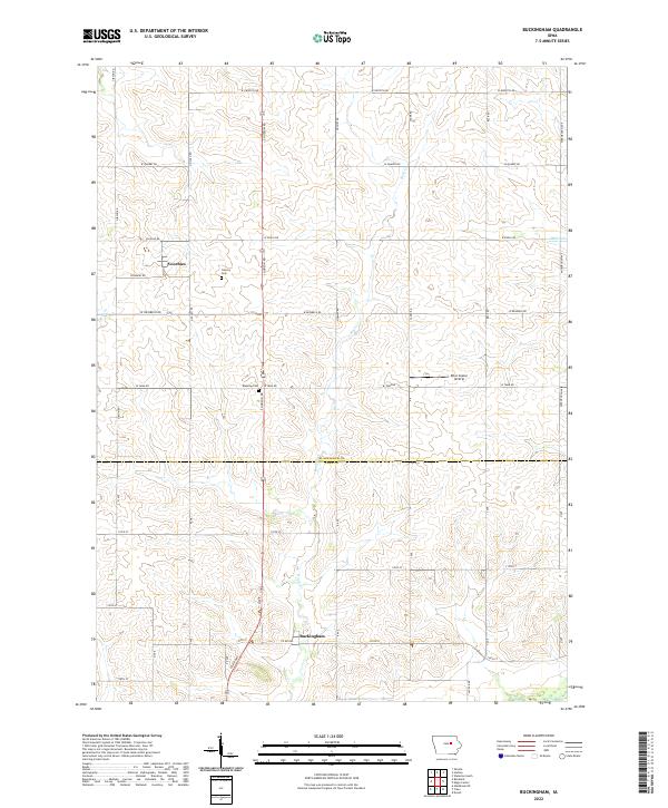
2022 Map of Buckingham
USGS Topo · Published 2022About this map
Buckingham and Voorhies anchor this agricultural landscape in southern Black Hawk County, just north of the border with Tama County. The terrain is defined by the gentle drainage patterns of Rock Cr, Miller Cr, and Given Cr, which weave through a strictly organized grid of rural section lines. Local genealogy and history are anchored at Calvary Cem and Blessing Cem, sites that represent the enduring community hubs of this farming region. The presence of the Ritel Copter Airstrip east of the S Hudson Road and W Tama Road intersection provides a modern contrast to the traditional rural layout. Tracing the roads like Voorhies Rd and W Reinbeck Rd reveals a landscape that has remained remarkably consistent in its township and range structure, reflecting the late 20th-century character of Iowa's interior plains.
Find a feature on this map
75 named features on this map. Tap any name to fly to it.
Don’t see what you’re looking for? This feature index may not catch every label — zoom into the map to look around manually.
Map Details
Editions of this 2022 Buckingham Map
This is the sole edition of this map. No revisions or reprints were ever made.
Other maps of this area

1954 · Waterloo
USGS Topo · 1:250,000

1955 · Waterloo
USGS Topo · 1:250,000

1963 · Buckingham
USGS Topo · 1:24,000

1963 · Hudson
USGS Topo · 1:24,000

1963 · Waterloo South
USGS Topo · 1:24,000

1963 · Eagle Center
USGS Topo · 1:24,000

1971 · Gladbrook NE
USGS Topo · 1:24,000

1971 · Zaneta
USGS Topo · 1:24,000
1971 · Dysart
USGS Topo · 1:24,000

1971 · Traer
USGS Topo · 1:24,000