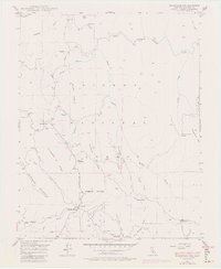
1947 Map of Buckingham Mtn
USGS Topo · Published 1981About this map
The South Fork Merced River carves through this Sierra Nevada landscape, where mid-century Mariposa County settlement was defined by narrow ridges and isolated mining operations. Small communities like Jerseydale and Darrah anchor the southwestern sections, connected by the winding Triangle Road. The local education and government footprint is visible at the Buckingham Mtn Sch and the Mariposa Guard Sta, while the rugged interior shows signs of earlier industry with the Early Mine and the Comet Mine (Aband). Several sawmills are scattered across the drainage basins of Skelton Creek and Owl Creek, illustrating the era's reliance on timber. High elevations are marked by prominent features such as Buckingham Mountain, Kirby Peak, and Chowchilla Mtn, with the historic Hite Trail providing a route through the northern canyons near Marble Pt.
Find a feature on this map
38 named features on this map. Tap any name to fly to it.
Don’t see what you’re looking for? This feature index may not catch every label — zoom into the map to look around manually.
Map Details
Editions of this 1947 Buckingham Mtn Map
5 editions found

Other maps of this area

1897 · Yosemite
USGS Topo · 1:125,000

1900 · Yosemite
USGS Topo · 1:125,000

1903 · Yosemite
USGS Topo · 1:125,000

1909 · Yosemite
USGS Topo · 1:125,000

1912 · Mariposa
USGS Topo · 1:125,000

1947 · Mariposa
USGS Topo · 1:24,000

1947 · El Portal
USGS Topo · 1:24,000

1947 · Mariposa
USGS Topo · 1:250,000

1947 · El Portal
USGS Topo · 1:62,500

1947 · Mariposa
USGS Topo · 1:62,500