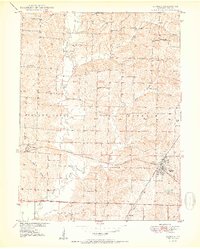
1950 Map of Bucklin
USGS Topo · Published 1950About this map
The town of Bucklin and the village of St Catherine anchor this 1950 topographical survey of eastern Linn County. The landscape is defined by the convergence of the Chicago Burlington and Quincy and Atchison Topeka and Santa Fe railroads, which facilitated the region's agricultural and industrial transport. Meandering watercourses like Yellow Creek and Long Branch cut through the terrain, providing a natural backdrop for a rural infrastructure dotted with local landmarks.
Find a feature on this map
26 named features on this map. Tap any name to fly to it.
Don’t see what you’re looking for? This feature index may not catch every label — zoom into the map to look around manually.
Map Details
Editions of this 1950 Bucklin Map
3 editions found
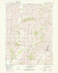
Other maps of this area

1946 · Brookfield
USGS Topo · 1:62,500

1948 · Brookfield
USGS Topo · 1:62,500

1949 · Rothville
USGS Topo · 1:24,000

1949 · Bucklin
USGS Topo · 1:24,000

1949 · Bucklin NW
USGS Topo · 1:24,000

1950 · Bucklin
USGS Topo · 1:24,000

1950 · New Cambria West
USGS Topo · 1:24,000

1950 · Rothville
USGS Topo · 1:24,000

1950 · Bucklin NW
USGS Topo · 1:24,000

1951 · New Boston
USGS Topo · 1:24,000