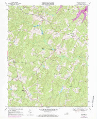
1968 Map of Buckner
USGS Topo · Published 1984About this map
Fredericks Hall and Buckner anchor the landscape along the Chesapeake and Ohio railway, marking a rural Virginia community defined by its watercourses and country churches. The terrain is bisected by the Little River, which feeds into the Swift Millpond and Bearden Pond. Notable for genealogists are the numerous rural congregations, including Bethpage Ch, Little River Ch, and Rising Sun Ch, each with nearby burial grounds.
Find a feature on this map
36 named features on this map. Tap any name to fly to it.
Don’t see what you’re looking for? This feature index may not catch every label — zoom into the map to look around manually.
Map Details
Editions of this 1968 Buckner Map
3 editions found
Other maps of this area

1887 · Spottsylvania
USGS Topo · 1:125,000

1890 · Goochland
USGS Topo · 1:125,000

1892 · Spottsylvania
USGS Topo · 1:125,000

1892 · Goochland
USGS Topo · 1:125,000

1942 · Mineral
USGS Topo · 1:31,680

1942 · Partlow
USGS Topo · 1:31,680

1942 · Contrary Creek
USGS Topo · 1:31,680

1942 · Pendleton
USGS Topo · 1:24,000

1942 · Buckner
USGS Topo · 1:24,000

1942 · Beaverdam
USGS Topo · 1:24,000