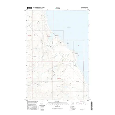
2017 Map of Buckroe
USGS Topo · Published 2017About this map
Lake Superior dominates the eastern edge of this Michigan coastline, where the rugged terrain of Marquette County meets the water at Thoneys Point and Saux Head Point. The landscape is defined by its complex hydrology, with the Big Garlic River and Little Garlic River carving through the highlands. A significant interpretive feature is the N Country National Scenic Trail, which winds through the southern interior past Blemhuber Lake and Echo Lake, offering a modern corridor through a territory once shaped by early northern industry and seasonal settlement. Small outposts like Birch and Buckroe sit along the coastal routes, while landmarks such as Garlic Mtn and Saux Head Hill provide verticality to the shoreline topography. The presence of Little Garlic Falls and numerous family-named creeks, including Harlow Cr and Nash Cr, highlights a region deeply tied to its wilderness drainage patterns and remote coastal character.
Find a feature on this map
42 named features on this map. Tap any name to fly to it.
Don’t see what you’re looking for? This feature index may not catch every label — zoom into the map to look around manually.
Map Details
Editions of this 2017 Buckroe Map
This is the sole edition of this map. No revisions or reprints were ever made.
Other maps of this area

1907 · Marquette
USGS Topo · 1:62,500

1953 · Marquette NW
USGS Topo · 1:24,000

1953 · Negaunee
USGS Topo · 1:24,000

1954 · Negaunee SW
USGS Topo · 1:24,000
1954 · Marquette
USGS Topo · 1:24,000

1954 · Negaunee
USGS Topo · 1:62,500

1954 · Big Bay
USGS Topo · 1:62,500

1954 · Marquette
USGS Topo · 1:62,500

1958 · Marquette
USGS Topo · 1:250,000

1960 · Marquette
USGS Topo · 1:250,000